Crater Lake National Park
A long weekend RVing at Crater Lake, on the edge of the Cascade mountains, plus a stop at the Rogue River Gorge.
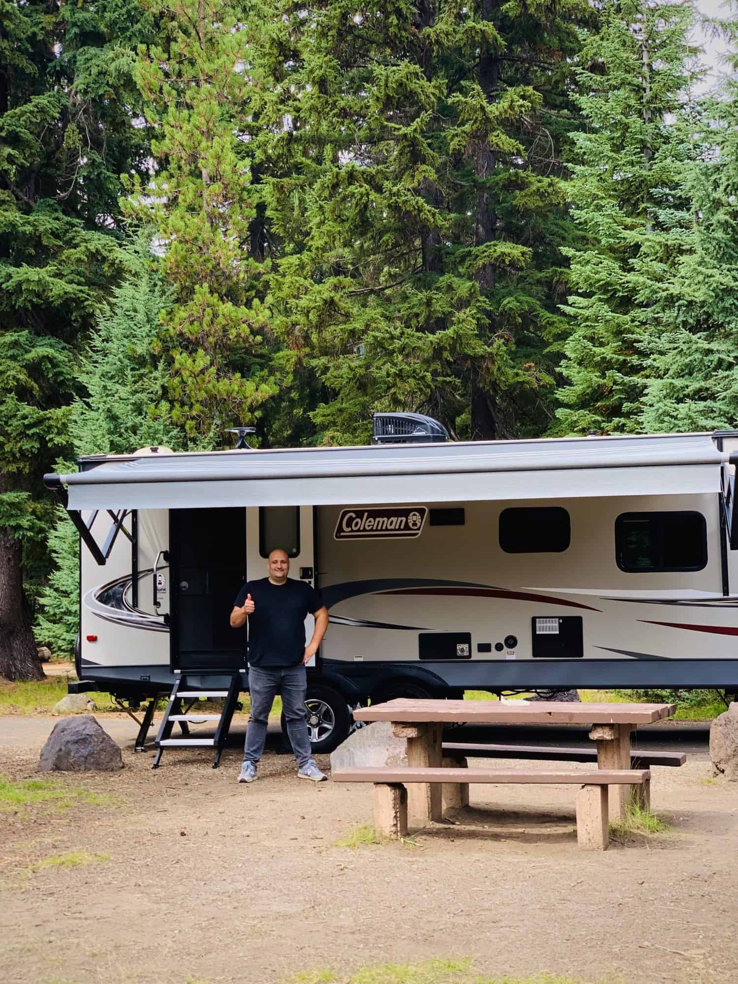
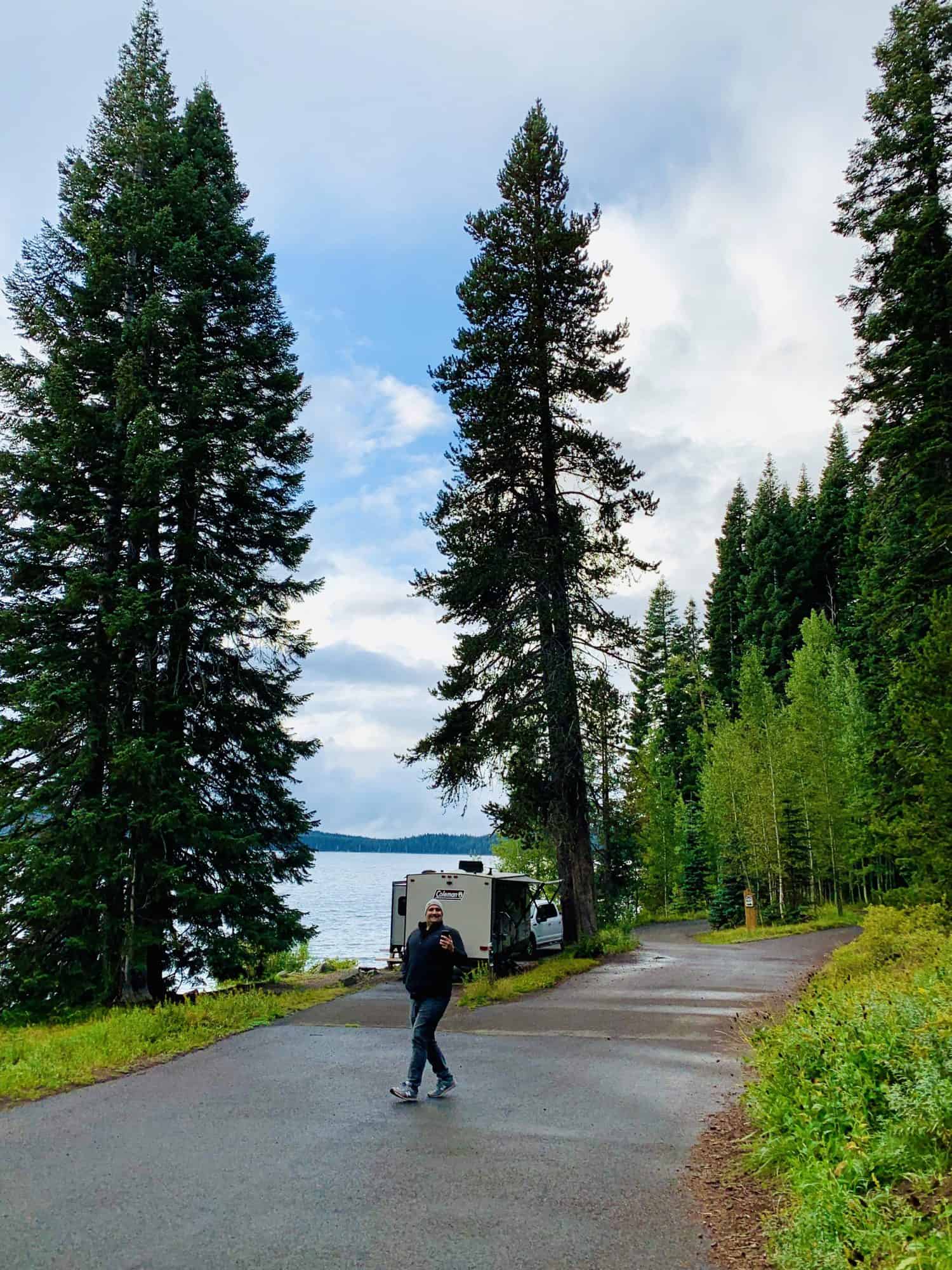
Our spot, D14, at Mazama Campground.
At Crater Lake National Park, tent camping is available at the Lost Creek campground, in the backcountry (with a background permit), and at Mazama Campground. For RVs, there's Mazama Campground, with spots ranging in cost from $31 with no hookups, $36 with electric, and $43 for full hookups, meaning both electric and sewer.
We planned to spend the weekend here, so Kyle and I could explore together, and then stay an extra couple days so I could get some hikes in.
We'd started traveling full time only 7 days earlier, and Crater Lake was our first stop outside of California. We came from the desert and shrubland of Lava Beds National Monument, about 100 miles south east. Now in dense forest, and at an elevation over 6,000 feet, we took advantage of the perfect weather and drove higher up to the rim of Crater Lake.


Day 1
Heading west on West Rim Drive around the lake, we made stops along the way to take photos, see the views, and learn about the area. We brought Oscar with us, knowing we wouldn't be getting on any hiking trails, but that he'd have a good time sniffin' smells and handstanding. At Crater Lake National Park, dogs are allowed on paved areas and within 50 feet of paved areas, so we knew he'd enjoy the trip too.

Wizard Island, a cinder cone within Crater Lake.


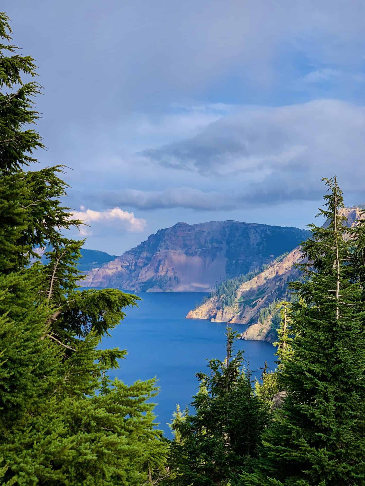
The beautiful, rich blue water is completely made of rain and snow. The deepest lake in the United States, it is also one of the cleanest and clearest large bodies of water in the world.
Crater Lake was created by the giant volcanic eruption of Mt. Mazama, over 7,700 years ago, the interior of the composite volcano collapsed and its caldera slowly filled with rain and snow.
Inside the lake is Wizard Island, a cinder cone volcano formed by later eruptions. (A volcano in a volcano!) In 1959, the US Coast and Geodetic Survey found that beneath the surface of the water is another volcano, Merriam Cone. (TWO volcanos in a volcano! As if one wasn't thrilling enough!) Because it can't be seen from the water's surface, they used over 4,000 echo soundings to understand the features of the lake bottom.
By the time we'd made it around to the northeast side of Crater Lake, the wind was billowing, cold, and sharp. Clouds were covering the sun, and a river of mist was jolting towards us as we scurried in and out of the truck for photos.


Phantom Ship in Crater Lake.
On the southeast rim of Crater Lake, at the Kerr Notch (created by glaciers!), is an overlook of Phantom Ship. According to a US Geological Survey report, Phantom Ship is made of 400,000 year old lava flows, making them the oldest rocks exposed within the caldera.

Day 2
The following day, we had less luck with weather and it rained almost continually.
We brought Oscar with us to the Steel Visitor Center and took him on the dog-friendly trail behind it (The Lady of the Woods Trail) before leaving him in the truck and checking out the exhibits inside.


It was a quick and easy hike, along a creek and historic buildings. The visitor center was busy and we spent a long time there, poking around, watching the park video.
Afterward, we decided to head to the Rogue River, and stop for a bite at Beckie's Cafe—both recommended to us by our camp neighbors at Burney Falls. Beckie's was started in 1926, and our neighbors said they've got the best homemade pies for miles in flavors like boysenberry, blackberry, strawberry rhubarb, and more. The pies were delicious, and I would definitely recommend it.
Behind Beckie's Cafe there are dog-friendly walking trails that are a part of the Rogue River-Siskiyou National Forest, and they wind over a creek and through dense trees, skirting by affordable (mostly empty, when we were there) campgrounds.


Sure enough, after a small hike through the forest, it started sprinkling and we decided to make the quickest little stop at the Rogue River Gorge before heading back to home base.
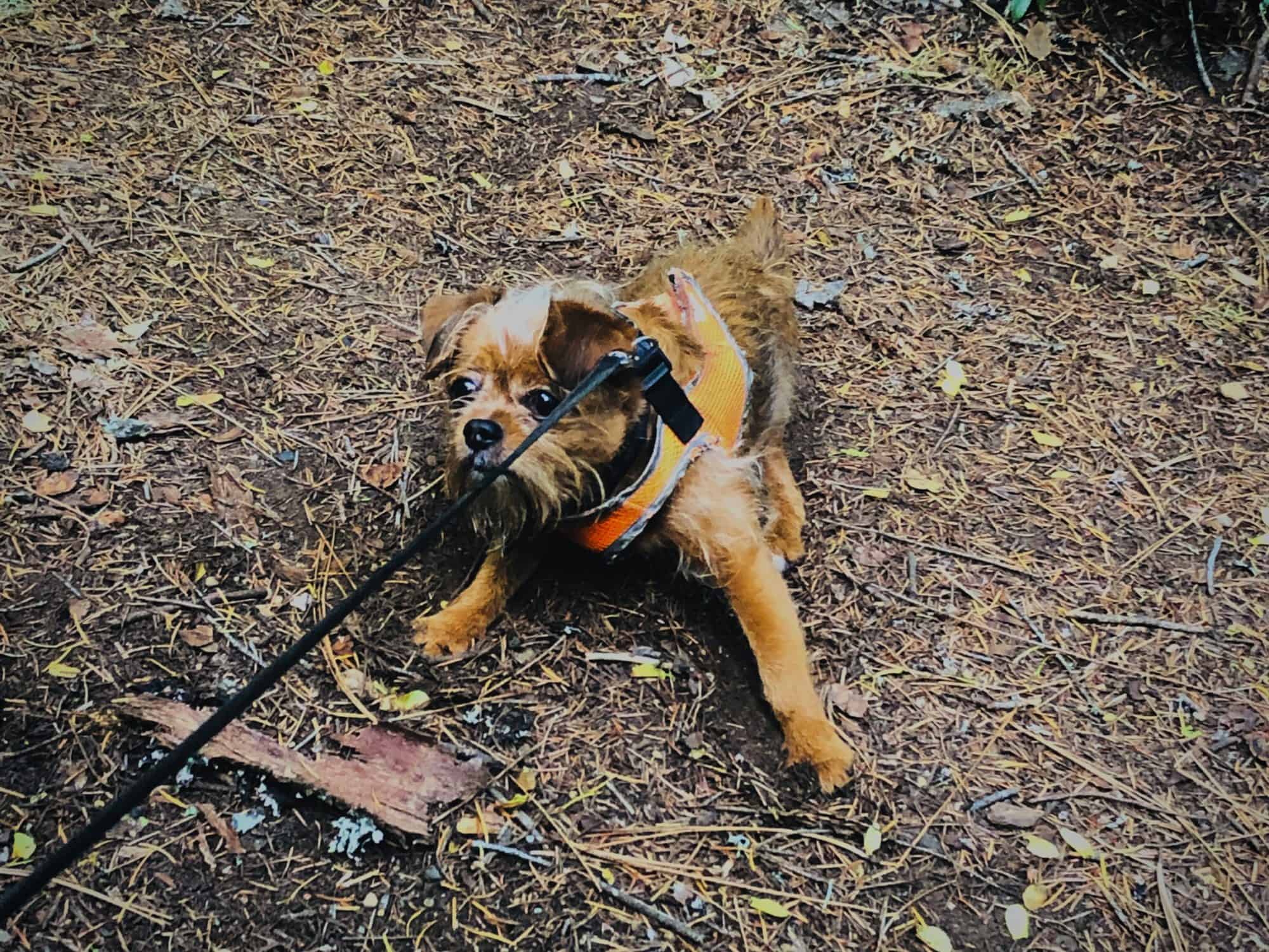
Oscar has always been a clever dog, and literally the second we tried to turn back around to head to the truck he resisted with all his six and half pounds of might. But I guess, in a forest this beautiful, who can blame him?
By the time we made it to the truck, neither of the boys wanted to make the stop, but despite the rain, I persisted. When we got there, big fat raindrops were pelting us as they came down, hard as hail.
I spent a while here looking at it all, thinking of how long people have lived here, how this land has changed over time, and what these petroglyphs have seen over the ages. With my head spinning, I headed home.

View from the Rogue River Gorge lookout.
For Oskee, who couldn't quite see over the edge of the lookout (and honestly couldn't care less for breathtaking views) it probably wasn't worth getting soaked. But for Kyle and I, it was worth it. It's always worth it.
I spent a while here looking at it all, thinking of how long people have lived here, how this land has changed over time, and what these petroglyphs have seen over the ages. With my head spinning, I headed home.
Day 3
Our third day I hiked up Mount Scott, the highest peak of the park at 8,929 feet. Kyle drove over to Cloudcap Overlook to get better cell reception and be close to me to pick me up once I was finished hiking.
To be honest, I made a very rookie move by deciding to hike Mount Scott when I did. It's a pretty solid hike, strenuous by the park pamphlet's standards because it's over 4 miles and has and elevation gain of 1,250 feet. It boasts panoramic views, and I let me excitement get the better of me and hiked up and down the mountain in a thick wall of fog like a dope.

The base of Mount Scott.

The briefest, best view I got for hours.

View over Scott Bluffs, looking north.
After a long walk in the cold, windy clouds, I met back up with Kyle and we lucked out with a RAINBOW. And I kid you not, the Oscar Meyer Weiner Truck drove by. I realize that without photos no one is going to believe me but I stand by that.
Defeated, I chose two short hikes to do on the way home, with a very small amount of hope that I'd be able to see anything. It seemed like the sky had cleared up, at least below 8000 feet of elevation, so we drove south and turned left to reach the trailhead for Plaikni Falls. Easy, quiet, serene hike. Lots of the trees looked like they'd seen better days, until the very last stretch of the hike that followed a creek and led right up to the beautiful falls.
Then we went to the end of the road, which dead ends at the Pinnacles Overlook. The trail is super easy, less than a mile round trip, and Kyle joined me since it was quick. This stuff was nuts. We were looking down into a forested gorge that Wheeler Creek runs through, and the sides of the gorge were all studded with fumaroles. Fumaroles are these solid earthen pyres created from volcanic gases rising up through ash and hardening.

Plaikni Falls.

Fumaroles from the Pinnacles Trail.
That essentially summarizes our long weekend RVing at Crater Lake National Park. I'd love to see it again, perhaps in the winter, and spend some time camping out in Rogue River National Forest. This area is beautiful, and I so hope to spend some time exploring the rest of Cascades.
From here, we headed north toward Bend, Oregon, and made a stop along the way at Diamond Lake.
Explore more...

Crooked River RanchRV Park

Smith Rock State ParkState Park

Bend, OregonCities, National Forest
Diamond LakeNational Forest

Crater Lake National ParkNational Park

Lava Beds National MonumentNational Monument
Burney Falls State ParkState Park

Lassen Volcanic National ParkNational Park

Lassen National ForestNational Forest

The DecisionPersonal
Leaving San FranciscoPersonal